Creative Minds 𖹭 Happy Hearts

License Plate Game Printable, All 50 States Plus Mileage Log
Numbered checkboxes for all 50 states, a mileage log, a sightings checklist, and a blank drawing box, packed onto one sheet you print before you leave the driveway.
Four sections fill this single-page layout. The largest, labeled “Can You Find All 50 States?”, arranges all 50 states in numbered checkboxes across five columns. To the right, a Mileage Log table holds four columns: Date, From, To, and Miles, with several dotted rows for logging daily legs. Below the state grid, a “Things I Spotted” checklist covers 18 roadside items from big trucks and wind turbines to silos, deer, and tunnels, each paired with a small icon. A bordered “Draw Your Road Trip” box in the lower right gives kids a blank space to sketch a favorite moment from the journey.
This is one of the activity sheets in the Road Trip Games collection, built to carry a full trip from start to finish rather than just one game. The state grid checkboxes are sized for a single pen tick, the mileage rows fit a few words of city names comfortably, and the drawing box is generous enough for a real scene. It suits one child per copy, so printing a set at the start of a multi-day drive keeps everyone occupied independently.
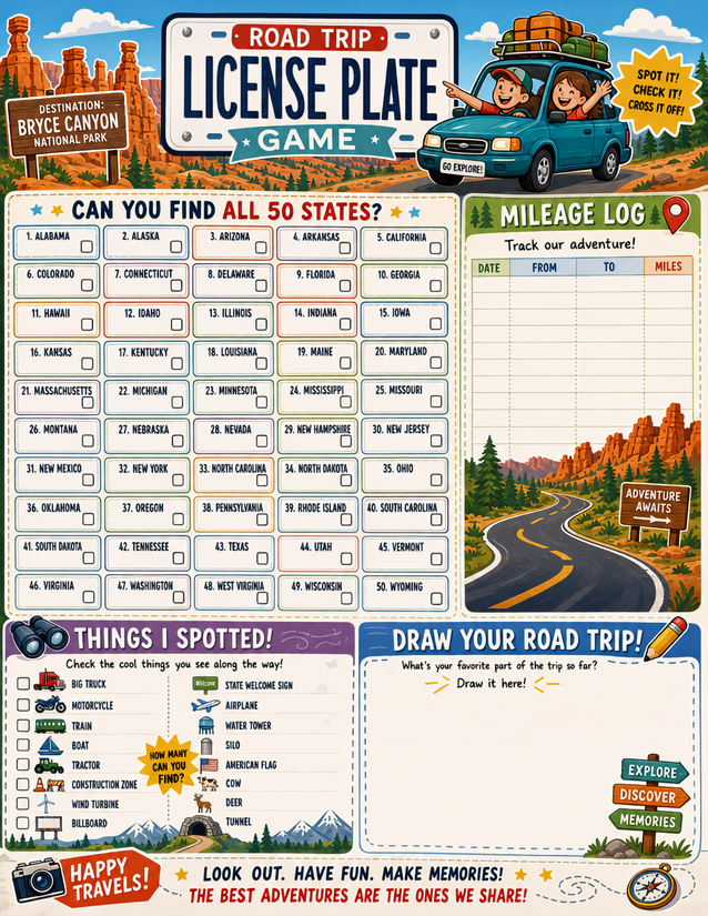
Spot, check, and cross off every state with this license plate game printable all 50 states sheet, plus a mileage log and drawing prompt. Free download.
Setting Up the License Plate Game Printable All 50 States Sheet

Usage Notes
Gel pens with a 0.5 mm tip fill the state checkboxes cleanly without bleeding into neighboring cells. The mileage log columns are narrow, so a fine liner or a sharp pencil keeps city names legible across the Date, From, To, and Miles fields. The drawing box at the lower right is unlined, which means any medium works there, colored pencils, ballpoint sketching, or even a quick marker doodle. Lamination is only practical if you skip the drawing section, since that area needs real marks to be meaningful.

Printing Tips
Cardstock at 28 lb handles repeated folding and unfolding across a multi-day drive better than standard copy paper. Print one copy per traveler before departure so nobody is waiting on a shared sheet when a rare plate appears.