Creative Minds 𖹭 Happy Hearts

Joshua Tree Road Trip Printable, License Plate, Mileage Log and Spotter
Bound for the desert? The Joshua Tree road trip printable packs a full state tracker, a mileage log, a 20-item spotter list, and a blank drawing panel onto one sheet.
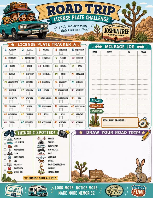
Four sections fill this page. Top left is the License Plate Tracker, a numbered grid listing all 50 states alphabetically from Alabama to Wyoming, each with a small checkbox beneath it. Top right is the Mileage Log, a ruled table with Date, From, To, and Miles columns and a Total Miles Traveled line at the bottom. Bottom left is Things I Spotted, a two-column checklist of 20 items including Mountain, Lake or River, Farm, Wind Turbine, Train, Silo, Billboard, Gas Station, School Bus, Bridge, Tunnel, Camper/RV, Motorcycle, Boat, Airplane, Horse, Road Construction, Wildlife, and Joshua Tree, with a bonus prompt to spot all 20. Bottom right is Draw Your Road Trip, an open dotted-border box for sketching scenes from the drive.
This Joshua Tree road trip printable is built for a specific destination trip, so the Joshua Tree callout at the top doubles as a keepsake header. The mileage log has roughly eight ruled rows, enough for multi-day legs. The spotter list suits kids who need a structured task at hand, while the drawing box gives them somewhere to put what they actually see. It fits naturally alongside the other activity sheets in the Road Trip Games collection.
Headed to Joshua Tree? This Joshua Tree road trip printable tracks plates, logs miles, and tallies 20 roadside sights on one sheet. Free instant download.
Making the Most of Your Joshua Tree Road Trip Printable

Usage Notes
The mileage log columns are narrow, so a fine liner or a 0.5 mm ballpoint keeps entries legible without bleeding into adjacent columns. The spotter checkboxes are small squares, finger-tip size, so a regular ballpoint or a fine-point felt tip checks them cleanly. The drawing panel is unlined and generous enough for a pencil sketch the kids can color in later with whatever is rolling around the back seat. Laminating the sheet and using a dry-erase marker lets you reuse the mileage log on return trips.

Printing Tips
Cardstock at 32 lb or heavier holds up better on a multi-day drive than standard copy paper, especially if the sheet is passed between passengers. Leave the default margins as-is rather than scaling to fit, because the grid text is already small and reducing it further makes the state names hard to read. Printing a copy for each traveler before you leave means nobody argues over whose turn it is to hold the sheet.